Whilst researching for this blog it has come to my attention that approximately 36 streets have disappeared from the Hyde area over the years.....and that's just the ones I've noticed so far!
Helen St
Norbury St
Foundry St
Platt St
Thomas St
Albion St
Cotton St
Mottram St
Lewis St
Spring St
Haughton St (Godley)
Hoviley Brow
George St
Bank St
George St West
Cooper St
Hewitt St
Wharf St
Oak St
Lucas St
Charles St
Hall St (Not Newton)
Rochfort St
Cooper St
Alma St
Mill St
Randall St
Howard St
Oak St
Thomas St (Flowery Field)
James St (Flowery Field)
John St (Flowery Field)
Mulberry St (Flowery Field)
High St (Flowery Field)
John St East (Flowery Field)
Broadbent St (Flowery Field)
Mount St (Flowery Field)
Please feel free to add any other you might be able to think of!
21 comments:
It would be good to get a collection of their pictures Nancy, include one or two in each post along with a map showing where they were, add any information we can come across. Anyone researching past family members would find this of great interest. Great post Nancy..
catherine street
mary street
elizabeth street
Anonymous: Cheers for adding these to the list...
Thanks Anon .Technically they're still there according to google maps but there are no longer any houses on them so they are as good as gone.
Another interesting slant on this post is that some of them are essentially still there, as a right of way if nothing else - and according to that mapping website you told me about Tom, pretty accurately :>)
* Cheapside - now just a short stretch alongside the Sportman Inn, still exists as a footpath through Morrisons carpark & through the M67 subway onto Hoviley (known as Cheapside Subway, according to the highways agency plate above!)
* Lewis Street is now the entrance to Morrisons carpark.
* Beeley St & Thomas St are now the main roadways within Hydes main carpark next to Union St.
* Platt St is now the service yard for Clarendon Square.
* Foundry Street is now the walkway in Clarendon Square (is it now Rutherford Way???)
* Port St is now Old Court Street opposite ASDA, and then a short passageway leading onto Market St - the old Port St roadsign is still there above Zeenath's electrical store.
...and there's probably more still...
Great info ,Ian. I omitted some streets as they are still listed as streets on google maps etc but it's interesting that some like Platt Street are still used without having their names. Thomas Street started at Mount street and has Chartist House built over the top part of it but as you say the bottom part is still there. We should start a campaign to get these streets renamed as they were originally known. :)
Excellent information Ian.. I never knew it was called the Cheapside Subway and Jane pointed out the 'Port Street sign last week.
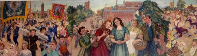
I keep saying this... we come across a bit of an idea, or snippet of information and it leads to so much more... Helen street can be seen on Harry Rutherfords painting, he even painted in the street lamp diagonally across Helen Street on the market square...
Someone told me a few years ago that they had seen an old sign saying ABC Lane in the Werneth Low area, but I havn't been able to find any evidence of it. There is still an Oak Street in Hyde between Fleet Street and Commercial Brow.
Exiled Hydonian....
Thanks from this.... I have read something of late that mentioned ABC Lane... but can't remember where... if I come across it I will try to include it in a post..
Thanks from commenting.
Hi
Can anyone help me locate Lucas St?
I think it used to be in Hyde-St George's parish
Interested in locating it as my GrandParents lived there.
No living relatives can help!
Colin Burgess - another exiled Hydonian!
Hi Colin...
I'm not to sure myself but it dose ring a bell.... I'm sure Nancy will be able to help with this. You can always contact us by email as well Colin and we will see what we can come up with.
LUCAS STREET
Just checked a 1910 map Colin.. seems it was where Asda Superstore is now. If you was coming up Great Norbury Street, it was on the left before Corporation Street. Part of it is still there it leads to the Mosque.. If you go to http://mosques.muslimsinbritain.org/show-mosque.php?id=1822 it shows the bottom of what would have been Lucas Street. I knew it rang a bell... I would have seen it when I went to school at Greenfield Street.
Thank you - which map did you use?
Colin
Hi Colin.... the maps can be found here http://maps.cheshire.gov.uk/tithemaps/TwinMaps.aspx
Make sure you have some spare time... they get a bit addictive ha!
Agree - thank you - just spent ages looking at all sorts of things to do with my family addresses!
Glad to be of service Colin...if we can be of any assistance our email is at the top right.
My mum worked at Hyde Laundry which is now Byles.
Me and my sister would be dropped off at our Auntie Annnies who lived at No 2 Thomas Street. There is a footpath there now that leads over to Iceland and I always say that step is my auntie Annies doorstep.
At the entrance to the mall used to be 18 Platt Street which was at one time a beerhouse which was called Brown Cow, this is the house my mum lived in prior to her marriage.
I must look out for the step now Jean.. you should write these memories down Jean.. I have enjoyed reading them.
Railway View,
It was opposite Providence Mill, off alexandra street.
Thank you anon...
I went onto the old Cheshire Tithe Map and looked at this area before the railway was built. I was looking for something else but as one dose with such maps you can't just look something up and come away... ha!
http://maps.cheshire.gov.uk/tithemaps/
Treacle Hill
Acorn Lane
Post a Comment